Construction drone services
Progress monitoring, LiDAR mapping, 3D digital twins, and volumetric analysis. From pre-construction through closeout — one data partner for the full lifecycle.
Rework is eating
your margins
Construction teams lose up to 30% of their schedule to rework caused by outdated surveys, misaligned teams, and design deviations caught too late. Manual site walks miss what aerial data reveals instantly — grading errors, scope creep, and safety hazards that compound into costly delays and change orders.
Why contractors choose drone data
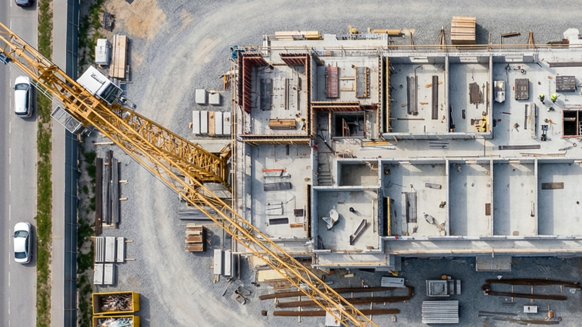
From groundbreaking to closeout, drone data replaces guesswork with real-time evidence. Track progress across the entire site, verify earthwork against design, share updates with stakeholders, and keep every team aligned — without extra site visits or delays.
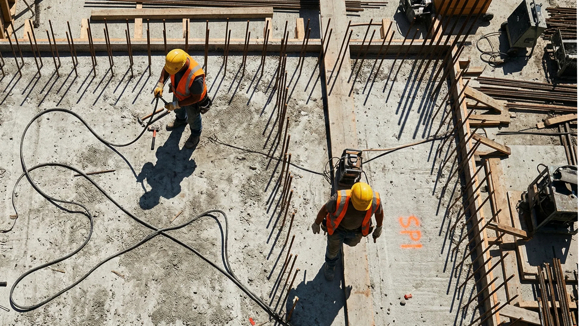
Complete site visibility
High-resolution aerial imagery documents conditions at every phase — verifying work, catching deviations, and creating a defensible visual record without disrupting operations.
Faster decisions, lower costs
Replace manual site walks with rapid aerial scans that cover more area in less time. Teams report 50–60% faster inspections and 25% less rework through earlier defect detection.
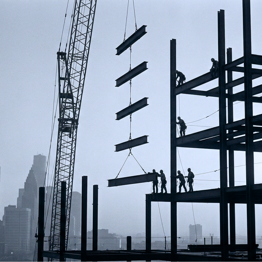
Safety and compliance
Eliminate the need for workers on rooftops, scaffolding, and active excavations. FAA-certified Part 107 operations that reduce on-site incidents and support OSHA compliance.
Stakeholder confidence
Share time-stamped aerial visuals with owners, investors, and project teams instantly. Centralized access improves alignment, reduces misunderstandings, and builds trust across the lifecycle.
Construction
drone services
Topographic mapping, 3D modeling, thermal imaging, volumetrics, and progress documentation — every data type your project needs, from earthwork to closeout.
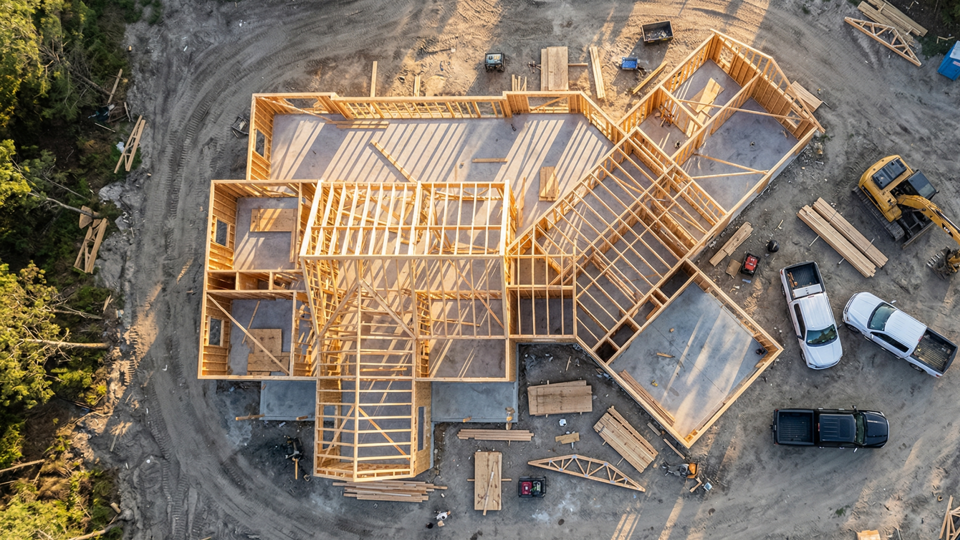
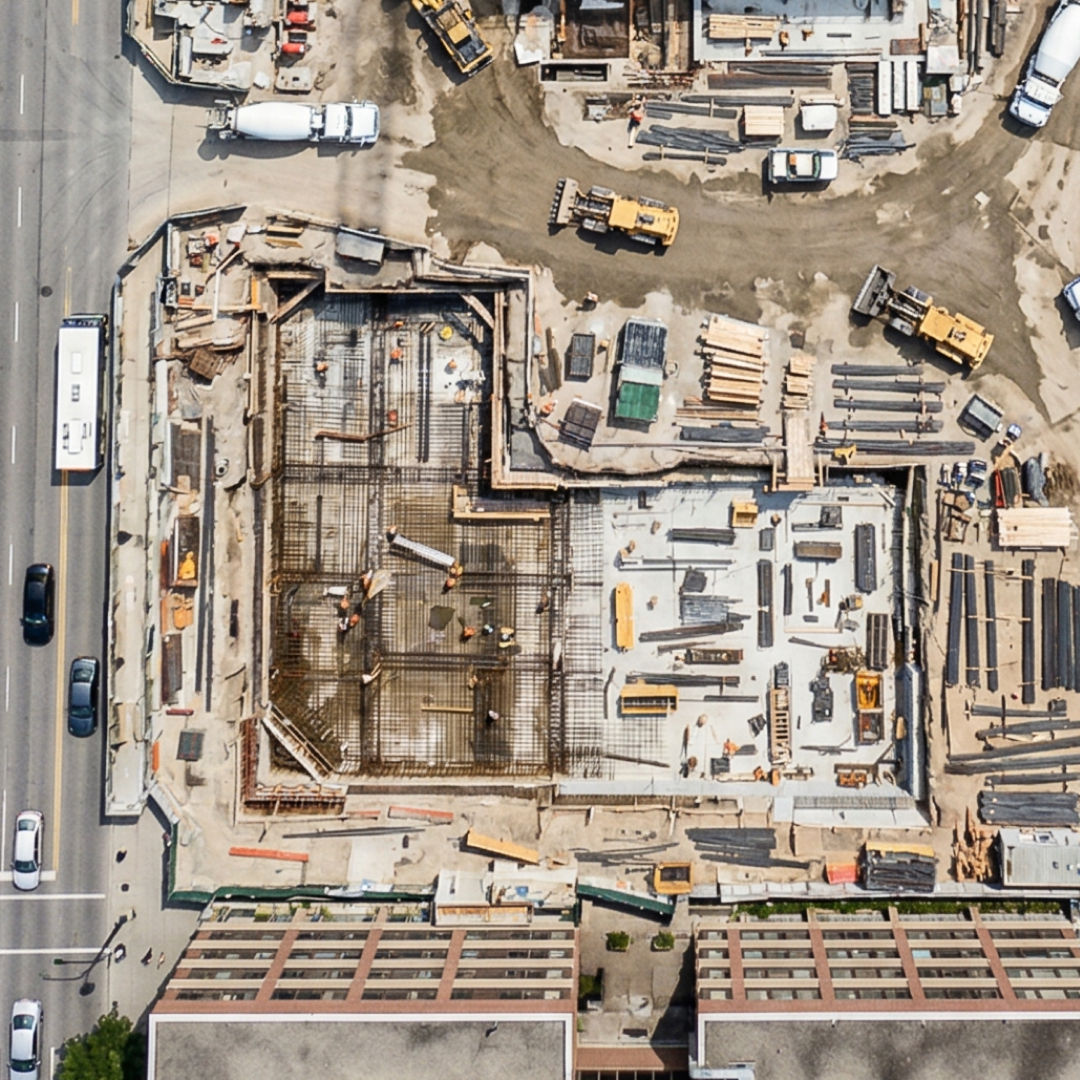
Progress Monitoring
Scheduled aerial captures with time-stamped comparisons to track crew productivity, verify milestones, and flag delays before they impact your schedule.
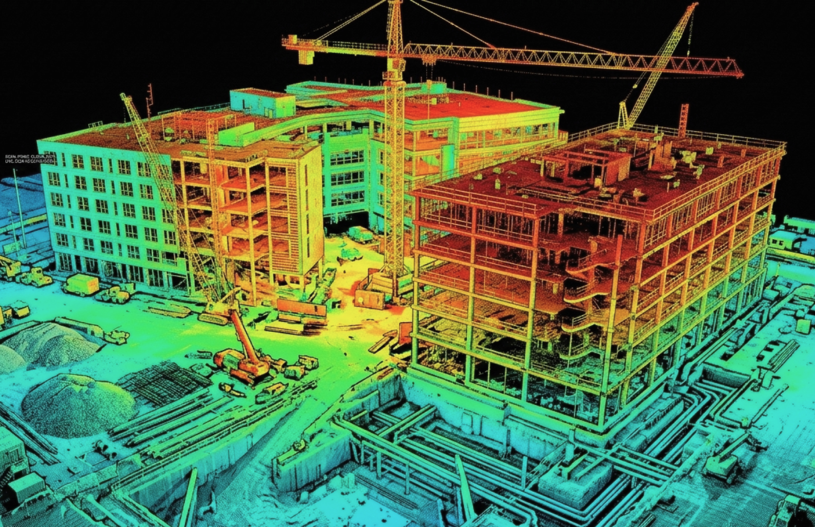
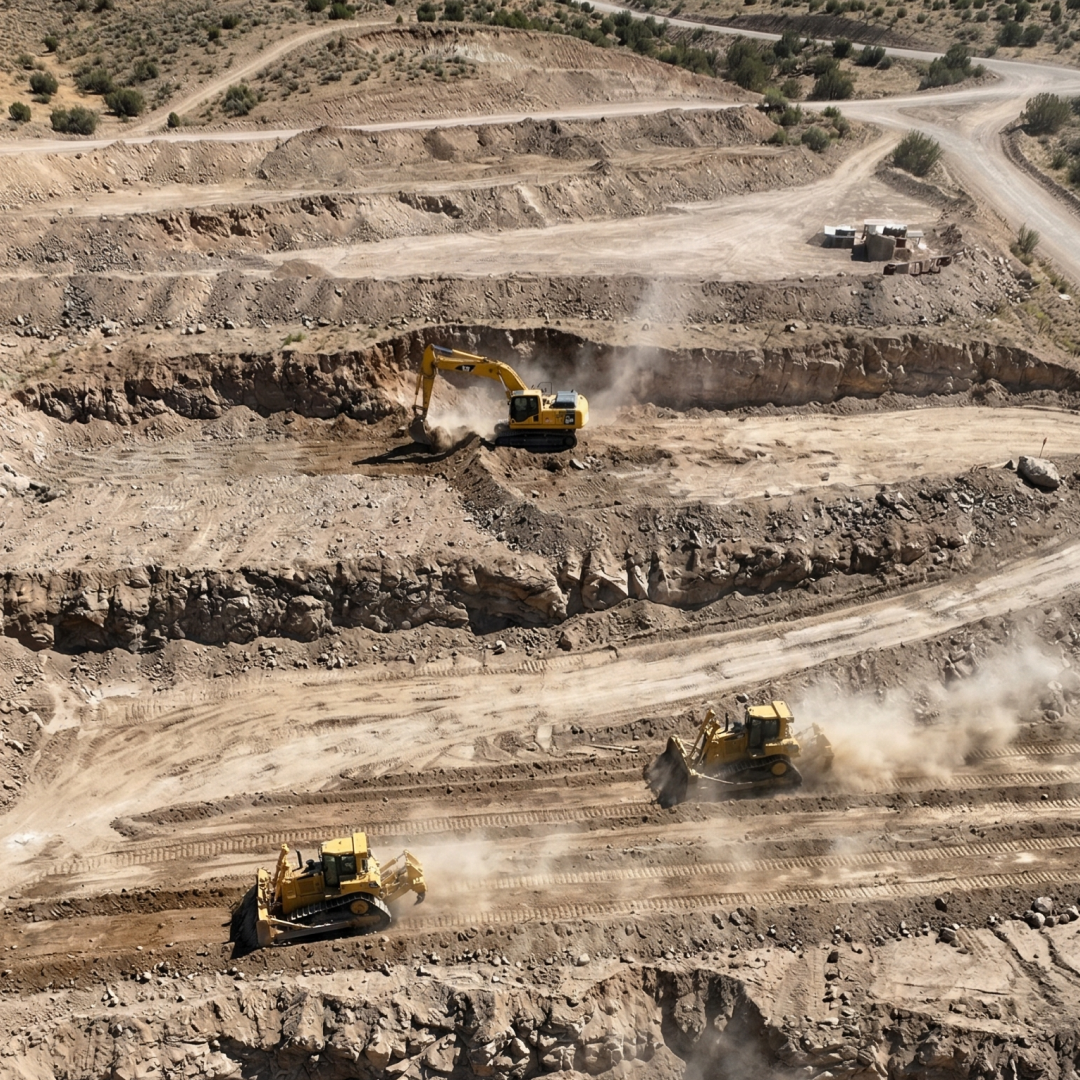
LiDAR & Topo Mapping
High-density point clouds and orthomosaic maps for cut/fill analysis, grading verification, and earthwork management — replacing weeks of ground surveying.
3D Digital Twins
Photogrammetric models to compare as-built conditions against CAD plans. Identify design deviations, constructability issues, and scope conflicts early.
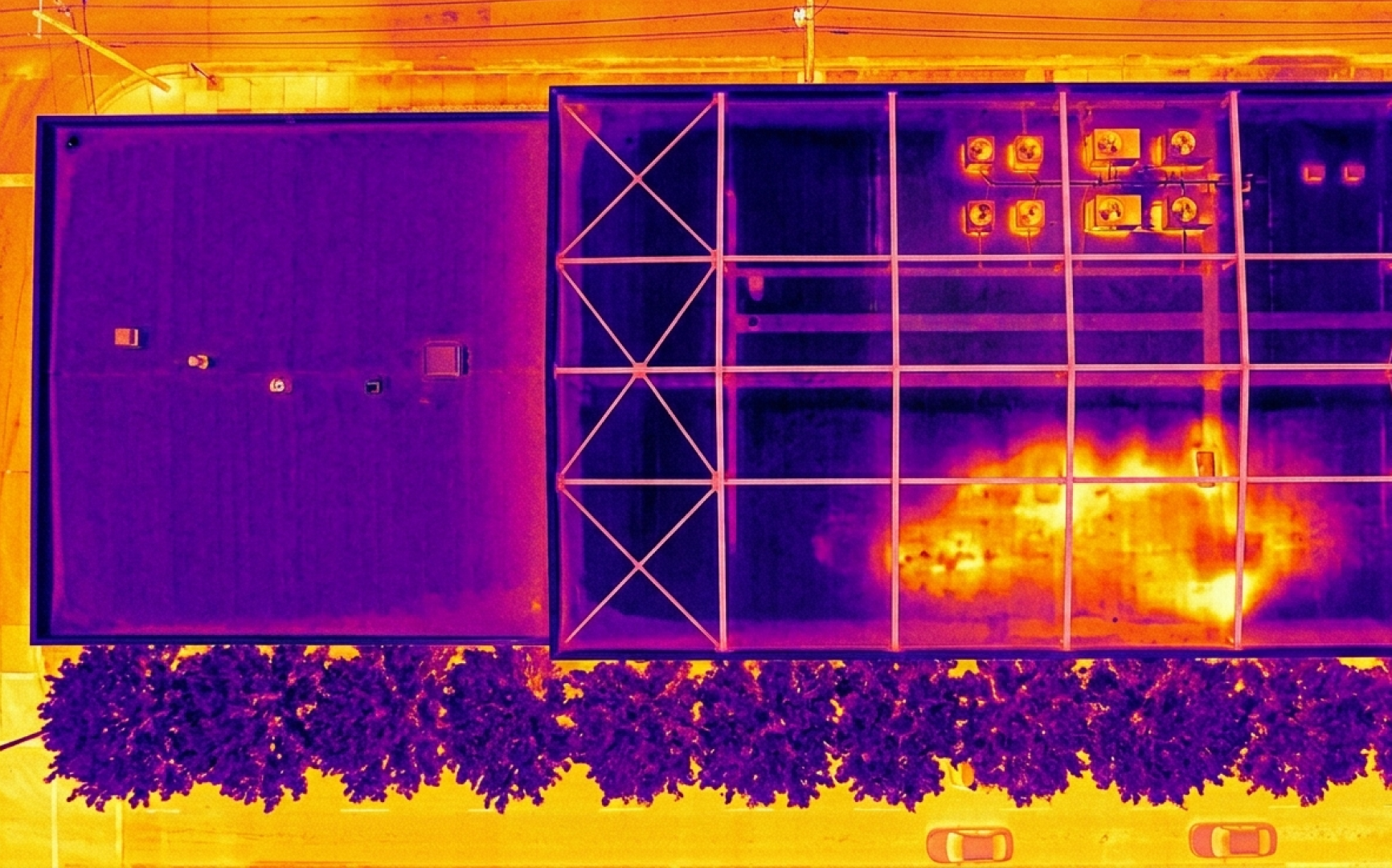
Thermal Inspections
Detect heat loss, moisture intrusion, and insulation gaps across building envelopes. Verify installation quality without scaffolding or shutting down operations.
LiDAR precision
Fewer delays
*Results based on LiDAR-calibrated datasets vs. traditional ground surveys.
From pre-construction
to closeout
Drone data supports every phase of your project — site selection, earthwork verification, vertical progress tracking, and final as-built documentation. One data partner across the entire lifecycle.
BIM-ready
deliverables
All deliverables export in industry-standard formats — .LAS, .OBJ, GeoTIFF, .DXF — ready to drop into your existing CAD, GIS, and BIM workflows.
Seamless BIM & Software
Our data flows directly into your existing construction tech stack. No custom pipelines, no compatibility headaches — just native support for the tools you use every day.
Getting started is simple
01. Tell Us About Your Project
Share your site boundaries, deliverables needed, and project timeline.
02. We Capture the Data
FAA Part 107 certified pilots fly your site safely and efficiently.
03. Actionable Insights in 48h
Download survey-grade maps, models, and reports ready for your workflow.
Build smarter
from above
Get survey-grade aerial data delivered within 48 hours.
The drone advantage
Why construction teams are switching to drone-based site intelligence.
Traditional Methods
Old Way
- Slow Surveying
Days of manual labor, high risk, and constant site disruption.
- Fragmented Reporting
Subjective progress photos and blind spots across the site.
- Late Error Detection
Deviations often found only after concrete has been poured.
- Personnel in Danger Zones
Workers required at heights, in trenches, and hazardous areas.
DroneOfficial Intelligence
New Way - Full Coverage in Hours
100% site surveyed with survey-grade precision, same day.
- Automated Digital Twins
Weekly 2D/3D overlays with full site visibility for every stakeholder.
- Real-Time Error Flagging
Cloud-based as-built vs. design comparison catches issues instantly.
- Zero Ground Risk
Remote data capture keeps your crew off hazardous terrain.
Common questions
Everything construction teams need to know about deploying drone intelligence on active sites.
ContactDrones capture aerial site data for progress monitoring, topographic mapping, 3D modeling, thermal inspections, stockpile volumetrics, and as-built documentation. They replace manual site walks and helicopter photography, surveying 600+ acres per day while creating a time-stamped visual record that supports accountability, invoicing, and bid accuracy.
Professional construction drone services typically cost $150–$400/hour or $1,000–$3,000 per project deployment. Ongoing progress monitoring runs $500–$2,000 per visit. Most firms see positive ROI within 12 months through 25% rework reduction, 60× faster surveys, and lower labor costs.
Yes. FAA-certified pilots operate under Part 107 regulations with full liability insurance. Drones eliminate the need for workers to access rooftops, scaffolding, trenches, and active excavations — reducing work-related injuries, lowering insurance liability, and supporting OSHA safety compliance on active jobsites.
Construction drones capture high-resolution photos, 4K video, orthomosaic maps, topographic surveys, LiDAR point clouds, thermal imagery, and volumetric measurements. All deliverables export in industry-standard formats (.LAS, .OBJ, GeoTIFF, .DXF) and integrate directly with Autodesk Revit, Civil 3D, Procore, Bluebeam, and Trimble.
Drone adoption delivers 15–25% improvement in project ROI. Construction companies report 25% lower rework costs, 50–60% faster inspections, and up to 30% schedule recovery through early deviation detection. Architects and engineers use drone data to minimize manual site visits, reduce design conflicts, and increase productivity on tight schedules.